
Register for the online Public Information Centre
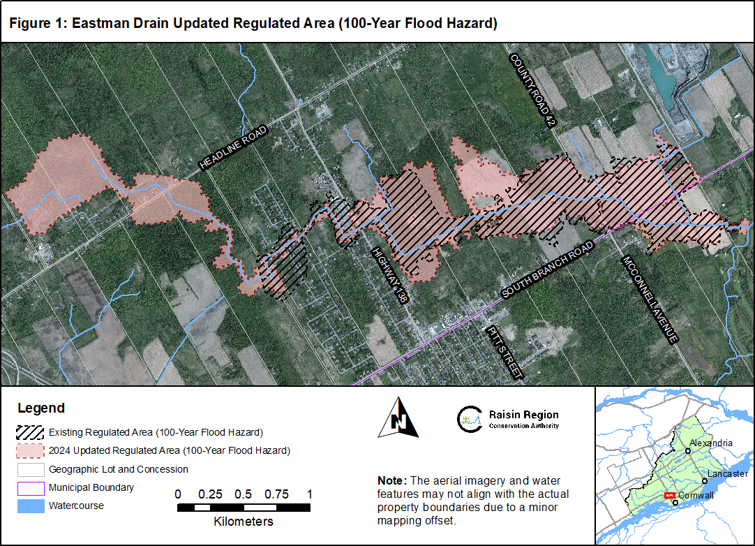
The Eastman Drain is a watercourse which passes through parts of the Township of South Stormont and the City of Cornwall. Recently, the Raisin Region Conservation Authority, United Counties of SDG, Township of South Stormont, and the City of Cornwall have partnered to update the flood hazard mapping for this watercourse. The study area spanned from north of Headline Road to southeast of the intersection of McConnell Avenue and South Branch Road.
Under the Conservation Authorities Act, the RRCA reviews development applications near water and wetlands to protect people and property from natural hazards (e.g. flooding, erosion). Flood hazard maps are essential components of these reviews and the current study will provide up to date information on the flood hazard in this area. It is important to inquire with the RRCA when considering development projects near water and wetlands as certain activities require review and permission from the RRCA. Flood hazard areas are also important components of municipal official plans and zoning schedules.
The flood hazard is the result of hydrologic and hydraulic investigations that show potential floodwater coverage for an annual exceedance probability of 1% (previously described as the 1 in 100-Year flood event). The flood hazard of the Eastman Drain was assessed and mapped in accordance with the current Federal Flood Mapping Guidelines and provincial requirements for regulatory flood mapping. The scope of work included field survey, hydrologic modelling, hydraulic modelling and flood map production.
This project is funded in part by the Government of Canada, the Government of Ontario, and the United Counties of Stormont, Dundas and Glengarry.
Download the updated 100-year flood hazard area (10 MB)
.jpg)